Privacy statement: Your privacy is very important to Us. Our company promises not to disclose your personal information to any external company with out your explicit permission.
Select Language
| measurement accuracy | |
| Measuring range | |
| Contactar ahora |
Modelo: XR3000C
Marca: Rxiry
Período De Garantía: 3 años
Personalización De Soporte: OEM, ODM
| Unidades de venta: | Piece/Pieces |
|---|
Incoterm: FOB,CFR,CIF,EXW
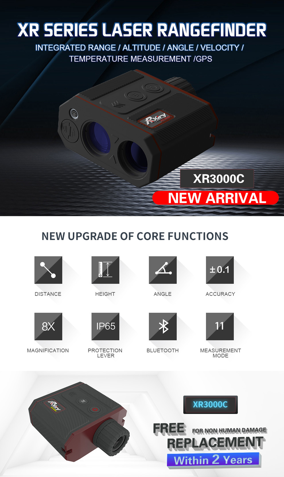
Ransfinder rxiry láser xr3000c
Rmitfinder de láser de la serie RXIRY XR , un instrumento de topografía definitivo para profesionales. En un diseño ergonómico , resistente y fácil de mantener, hay un botón de fuego, también llamado botón de medición y botón de modo. Fácil de operar.
En segundo lugar, repasemos las especificaciones clave
Ofrece 8 x ópticas superiores que mejoran su campo, la resolución 0.01 y la precisión del rango de 0.1m, el rango máximo puede ser de 6100 m.
Capacidad con AZ + INC + Cálculos integrados de Board: Calcula la distancia horizontal (HD) + Distancia vertical (VD) + Altura (HT) + Línea faltante 3D (ML)
Si su medida alguna vez estaba en cuestión, puede alternar en el modo cerrado y lejano para asegurarse de que el sensor láser ignore las obstrucciones no deseadas que están al frente o detrás de su objetivo deseado.
Para obtener más estabilidad, use Th4 1/4 ''-20 hilo para montar el telémetro en un personal o monópodo.
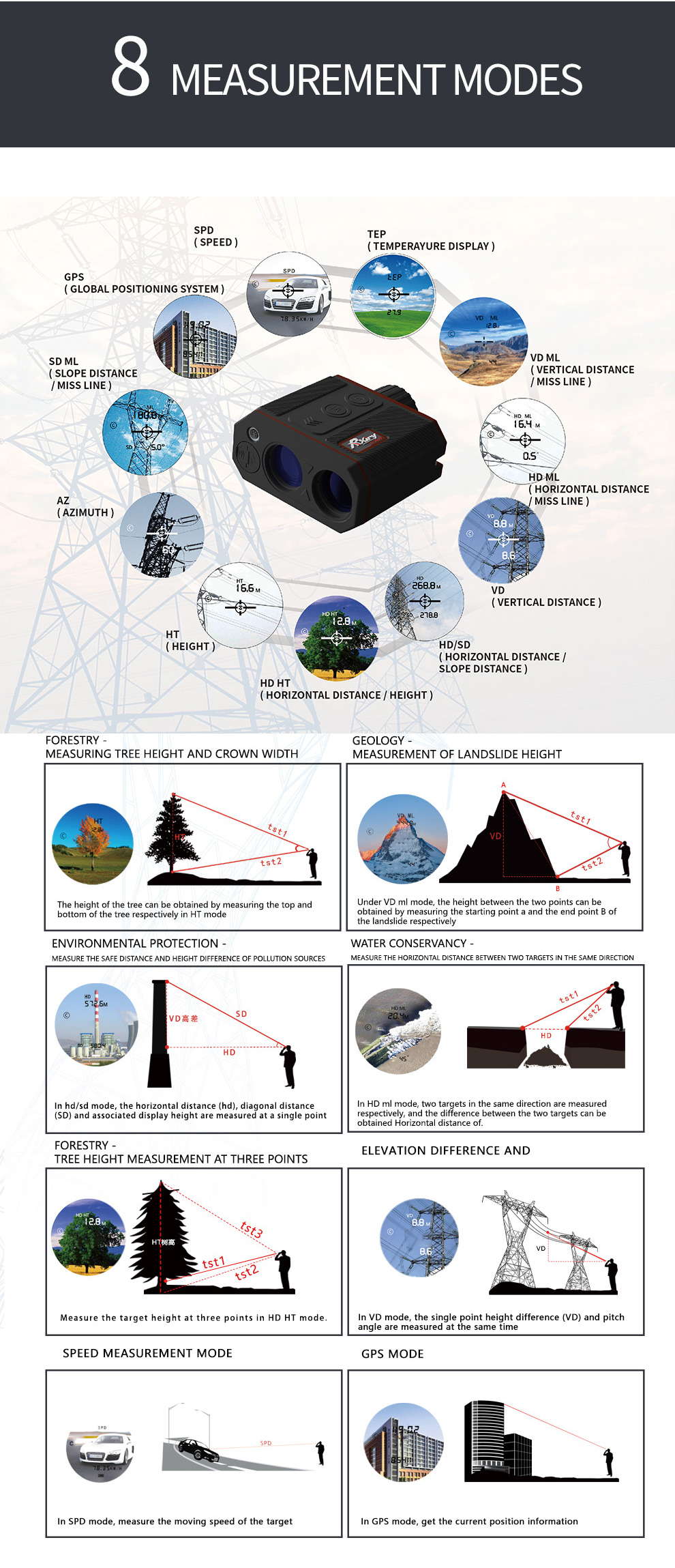
| SD Slope Distance |
Straight line distance between the rangefinder and the target. |
| VD Vertical Distance |
The distance between the target and the perpendicular to the path of the horizontal distance. |
| HD Horizontal Distance |
The level distance between the rangefinder and the plane of the target |
| INC Inclination |
The angle of inclination between the rangefinder at level and the target. |
| AZ Azimuth |
The magnetic heading to the target referenced to magnetic North |
| HT Height |
Three-step height routine. The final calculation represents the vertical distance between the points on the target represented by ANG1 and ANG2. |
| ML Missing Line |
Two-step Missing Line Routine finds the connecting vector (or missing line) between two points. The final calculation shows the SD, VD, HD, and INC associated with the missing line |
| SPD Speed |
Measure the speed of moving target |
| GPS | Collect the rangefinder GPS position information |


The file is encrypted. Please fill in the following information to continue accessing it


Privacy statement: Your privacy is very important to Us. Our company promises not to disclose your personal information to any external company with out your explicit permission.

Fill in more information so that we can get in touch with you faster
Privacy statement: Your privacy is very important to Us. Our company promises not to disclose your personal information to any external company with out your explicit permission.